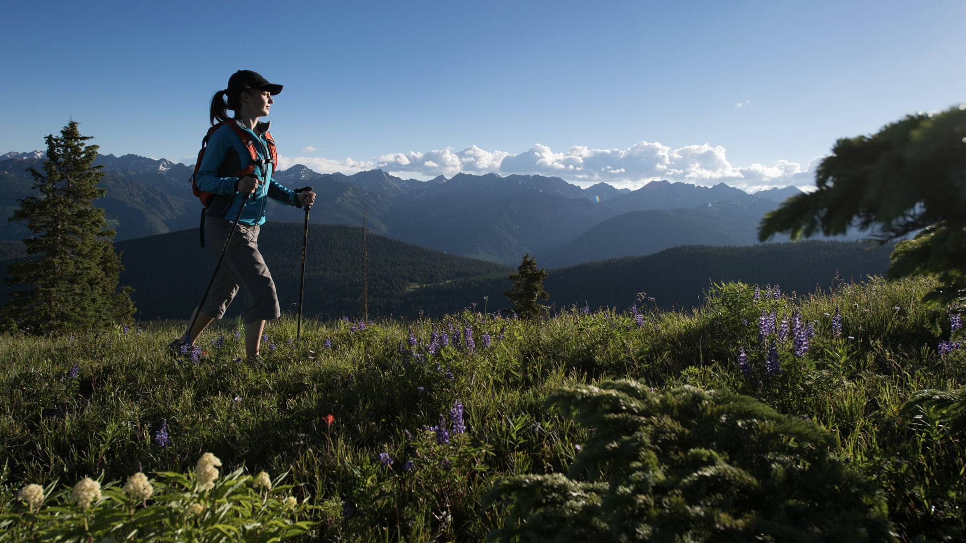

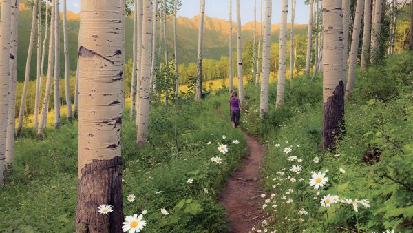
When the snow melts, Vail’s glorious hiking trails reveal themselves. You can easily find yourself at the edge of an alpine lake, surrounded by wildflowers, oohing and ahhing at all the breathtaking mountain scenery. Here you’ll find a whole spectrum of bucket-list hiking trails featuring everything from cascading waterfalls to stunning blooms and iconic vistas. There are plenty of casual hikes with little elevation gain that feature big payoffs, too.
Pack your sense of adventure (and peruse this handy list of what to bring). Don’t forget to pick up a Vail Welcome Center hiking map before you go.
Be sure to check if trails have seasonal closures. They are closed for a reason. To protect our wildlife during their fawning season.
Here are 10 Vail hikes (beyond Vail Mountain) to check out during your summer trip to Colorado.
1. Upper Piney River Waterfall
The Upper Piney River Falls hike is one of the most popular trails in the Vail Valley and located at one of the most beautiful settings in Colorado. The route begins at Piney River Ranch, and the trail starts to the left of the lake, where a colorful aspen forest welcomes you. Continuing on, you’ll quickly come to an opening where views of Piney Lake and the towering peaks of the Gore Range stand in the background. Stay right at every fork, and once you reach an overlook point looking back at the Valley and lake, you’re about 15 minutes from the scenic waterfall views.
📍Directions: Drive 11 miles up to Piney Lake via Red Sandstone Road #700
🚗 Park at the Piney Ranch parking lot. The dirt road can be fairly rough.
🧭 Distance: 6 miles, one way
↗ Elevation gain: 731 feet
⇄ Type: out and back
2. North Trail Sections
The North Trail provides 12 miles of trails for hiking and biking from Davos Road to Spraddle Creek (or the reverse). Dotted by shades of aspen groves along the way, the entire North Trail system is a favorite because of its accessibility and stunning scenery (think Vail Mountain, the Gore Range and Mount of the Holy Cross). For a full-day adventure, hike the entire length or choose a specific section. A nice starter hike is the 2.5-mile out-and-back hike to North Trail lookout point. For this one, you’ll want to start at Buffehr Creek Road trailhead and embark on a relatively short but challenging climb to the top of a flat clearing where you’ll enjoy panoramic views with Vail Village in the distance.
📍Directions: All trailheads are accessible from the North Frontage Road.
🚗 Depending on which section of the North Trail you want to hike, there is parking at trailheads at Cortina Lane, Buffehr Creek, Red Sandstone Road and Spraddle Creek.
🧭 Distance: North Trail Sections & Distances: Cortina Lane to Buffehr Creek (3.8 miles one way), Buffehr Creek to Red Sandstone (3.75 miles one way), Red Sandstone to Son of Middle Creek (3.9 miles one way)
⇄ Type: out and back or point to point
🚫 Closures: April 15 – June 20
3. Lost Lake Trail
One of the easier trails in the Vail Valley, Lost Lake Trail keeps its elevation gain to under 1,000 feet and delivers big with its swaths of aspens and lodgepole pines. The trail gradually climbs to its highest point, then drops slightly to Lost Lake. You’ll see mountain views of Beaver Creek, Vail Mountain and Mount of the Holy Cross along with Gore Range vistas at almost every turn.
📍Directions: From the North Frontage Road, proceed up Red Sandstone Road #700 for 3.9 miles to the trailhead (parking on the right).
🧭 Distance: 3.7 miles, one way
↗ Elevation gain: 941 feet
⇄ Type: out and back
4. Gore Creek Trail
If you’re up for the “whole shebang,” Gore Creek Trail is a full-day hike to a turquoise alpine lake. The trail winds through aspen groves, meadows and pine stands in the gorgeous Gore Creek drainage. There are some steep sections, but it’s all worth the effort — and there are many pleasant picnic spots along the way. At mile 4, the trail forks and you can choose to go straight over Red Buffalo Pass (ending in Summit County) or fork left to Gore Lake. Things level out when you get to the lake where you may be greeted by unconcerned mountain goats! The beauty of the Gore Creek/Lake Trail is that you can traipse along for as short or long as you like. To Gore Lake, it’s roughly 5.5 miles with breathtaking scenery the entire way. You’ll spend most of the hike listening to the sounds of Gore Creek as you walk beside it.
📍Directions: Take exit 180 from I-70 in East Vail. Head east down Bighorn Road approximately 2.5 miles to the end of the road. The trailhead is on the left before you reach the campground.
🚗 Parking is limited, so consider taking a bus.
🧭 Distance: 5.48 miles one way to Gore Lake
↗ Elevation gain 2,679 feet
⇄ Type: out and back
4. Shrine Ridge Trail
Shrine Ridge Trail off Vail Pass is a gradual, short hike through lush pine meadows and two small ponds that take you to the top of Shrine Mountain. A must-see around mid to late summer, this trail pops with incredible fields of wildflowers in a kaleidoscope of hues. Plus, you’ll be rewarded with incredible 360-degree views of Copper Mountain, Mount of the Holy Cross, the Gore Range and Vail’s Back Bowls. Pro Tip: This trail starts at 11,000 feet, so be prepared for cooler temperatures and changing weather.
📍Directions: I-70 to Exit #190 for Vail Pass. Exit here and turn right, heading west onto the Shrine Pass dirt road (FSR 709). Follow this well-graded road 2.4 miles just past Shrine Pass. The trailhead is on the left.
🚗 Parking is limited at this trailhead.
🧭 Distance: 2.2 miles, one way
↗ Elevation gain: 793 feet
⇄ Type: out and back
5. Deluge Lake Trail
Excellent for birdwatching, the Deluge Lake Trail is a lengthier option for those looking for a more strenuous hike. The trail passes through several boulder fields and then clings to a steep slope as it climbs through aspen stands. At mile 3.2, the trail drops to Deluge Creek, and you’ll get to navigate a creek crossing. The path becomes gentler as you follow the creek to the lake where you’ll be rewarded with views of the Sawatch Range and Mount of the Holy Cross. This nearly 9-mile, round-trip trail tends to be less crowded, and is also dog friendly.
📍Directions: Take exit 180 from I-70 in Eagle Vail. Head east down Bighorn Road approximately 2.5 miles to the end of the road. The trailhead is on the left before you reach the campground.
🚗 Parking is limited, so consider taking the bus.
🧭 Distance: 3.8 miles, one way, to the lake
↗ Elevation gain: 3,006 feet
⇄ Type: out and back
6. Grouse Lake Trail
The Grouse Lake trailhead is located just before the town of Minturn and ends at the picturesque, high-alpine Grouse Lake, one of the prettiest lakes in the valley. The trail rises through aspen, pine, spruce and fir trees. There are short, steep sections and several “false summits” (meaning you’ll think you’re at the top only to have to keep going), but you’ll have the chance to cool off as you cross water six times over bridges, logs and stones (maybe pack an extra pair of socks …). The final climb takes you through a series of meadows as you enter the Holy Cross Wilderness and find Grouse Lake at the foot of Grouse Mountain.
📍Directions: I-70 take the Minturn Exit #171, head towards Minturn on Highway 24 for approximately 1 mile to the trailhead on your right.
🚗 Parking at the trailhead is on the right.
🧭 Distance: 4.6 miles, one-way
↗ Elevation gain: 2,865 feet
⇄ Type: out and Back
7. Pitkin Lake Trail
Pitkin Creek Trail makes for an adventure-filled day with a tumbling waterfall and crystalline lake as the payoff. Less traveled than its neighbor Booth Creek Falls, this gorgeous trail starts off steep, but quickly levels out as it winds through an Instagram-worthy aspen grove, grassy meadows and stands of lodgepole pines. Keep watch for Pitkin Falls, around 2.5 miles into the trek. The last half of the trail ascends the valley to the stunning lake that sits below East and West Partner peaks.
📍Directions: Take exit 180 from I-70 in East Vail. Turn right onto Fall Line Drive and continue to the trailhead on the left side of the road before the Pitkin Creek Townhomes.
🚗 Parking is limited at the trailhead.
🧭 Distance: 5 miles, one way
↗ Elevation gain: 2,921 feet
⇄ Type: out and back
8. Game Creek Trail
Your chances of seeing wildlife are high along Game Creek Trail that parallels rushing water. It’s a somewhat lesser-known trail, because the most difficult part about it is simply finding the trailhead! The trail is peppered with seasonal wildflowers and, in August, bring a container to fill with wild raspberries. This can be an out-and-back hike or make it an all-day destination with the intent to reach the top of Vail Mountain. For a one-way trip, arrange a car shuttle to Vail and take the Eagle Bahn Gondola down to Lionshead. Pro Tip: You can hike this in reverse, starting atop Vail Mountain at the Eagles Nest, then head downhill, ending in Minturn.
📍Directions: I-70 take the Minturn Exit #171, head towards Minturn on Highway 24. Take the left immediately as you enter Minturn, going across the bridge by The Minturn Saloon. Follow Taylor Street until it dead ends.
🚗 Parking is at the trailhead on the left.
🧭 Distance: 3.6 miles, one way
↗ Elevation gain: 2,399 feet
⇄ Type: out and back, →🚗 or one way with a shuttle
9. Berry Picker Trail
Berry Picker is one of the signature hikes on Vail Mountain. Starting from Lionshead, the trail climbs steeply through aspen groves, mountain forests and grassy meadows over the 3.2 miles. This trek is not for the faint of heart: It should be hiked with proper gear and preparation. At the top, you have the option to hike back down or relax and rest on the ride down the Eagle Bahn Gondola.
📍 Directions: The trailhead is located at the base of Vail Mountain in Lionshead Village.
🚗 Park in the Lionshead Parking Structure.
🧭 Distance: 4.2 miles, one way (+2.4 miles, one way, to the lake).
↗ Elevation gain: 2,286 feet
⇄ Type: out and back or hike up and gondola down (if gondola is open)↗🚠 Some also take the gondola up and hike down
10. Bowmen’s Shortcut Trail
Bowmen’s Shortcut is a relatively moderate hike located off Vail Pass with a summit that’s often considered the “top of the world.” The 8.5-mile loop trail brings you in and out of dense forests along the rolling ridgetop until it opens up at the Top of the World meadow, boasting panoramic views of the Sawatch Range, Gore Range, Ten Mile Range and Vail ski area. Since the trail begins at 11,000 feet up, be prepared for cooler temperatures and changing weather. A wooden marker at the end of the meadow shows where the trail leaves the meadow. Pass the trail sign and proceed downhill right into the trees, climb a short bit, then descend quickly to Two Elk Pass. A sign here points out Two Elk Trail west 9 miles to Minturn or east 1.7 miles to the Old Vail Pass/ Vail Pass Recreation Trail. Take time to enjoy the views here before returning.
Alternate Route: This trail can also be used in conjunction with the Two Elk Trail. For those wishing to bike the Two Elk Trail from east to west, using the Bowman’s Shortcut Trail instead of the Two Elk Trail’s east trailhead eliminates the very steep eastern end of Two Elk Trail that rises 1,800 feet in 2 miles from the Vail Pass Recreation Trail.
📍Directions: I-70 to Exit #190 for Vail Pass. Exit here and turn right, heading west onto the Shrine Pass dirt road (FSR 709). At mile 2.3, you will pass the road for the Shrine Mountain Inn on the left and at mile 3.7, you will pass the Holy Cross Scenic Viewing Deck (known as Julia’s Deck) with a wheelchair-access ramp. At mile 3.9, turn right onto Lime Creek Road #728. You will pass Timber Creek Road #712 on the right at mile 4.4 and reach the trailhead on the right at mile 4.7.
🚗 Parking at trailhead
🧭 Distance: 8.5 miles
↗ Elevation Gain: 133 feet
◯ Type: loop or →🚗one way to Vail Mountain or Minturn
More Vail Hiking Information:
• Take a Vail wildflower hike
• Find paved paths perfect for strolling
• Get Vail Valley accessibility information
• Learn about the ins and outs of trail etiquette
• Check out a Vail brewery for a refreshing post-hike beer
• Use this wildlife guide when spotting critters on the trail
• Return for one of Vail’s top summer signature events