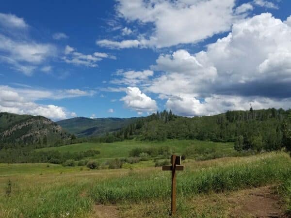
Please ensure Javascript is enabled for purposes of website accessibility
Skip to content
Active Hiking in Vail
Shrine Pass
A person and a dog pause on a trail in Vail surrounded by a meadow filled with gold and green foliage.

Grand Escape Trail

Distance
1.4 miles (one way)
Difficulty
Intermediate
Crowds
High
Beginning Elevation
9,686 ft.
Ending Elevation
10,329 ft.
Elevation Gain
643 ft.

The Grand Escape Trailhead begins at the top of Wildwood Express Lift area. This moderately challenging and well-marked trail promises breathtaking alpine scenery and panoramic views of the surrounding Gore Mountain Range. Keep an eye out for native wild flowers and wild life all along the way.

Grand Escape Trail

Care for Colorado: Leave No Trace

Exploring Vail goes hand in hand with caring for our beautiful natural environment. Here’s how you can do your part!

Stay on the Trail

No shortcuts — going off trail compromises trail construction, kills the vegetation, increases soil erosion and may result in reduced water quality.

Pack Out Trash

Stash it until you can trash it — anything you bring with you, you must pack back out. Trash can hurt wildlife and contaminate water ways.

Dog Do's and Don'ts

Do pick up the doo — pack out all dog poop. Don’t let dogs off leash to protect them from wildlife and protect wildlife from them.

Respect Wildlife

Give them space — observe wildlife from a distance and do not follow or approach them. Never feed animals as it can alter their behavior.

Plan Ahead

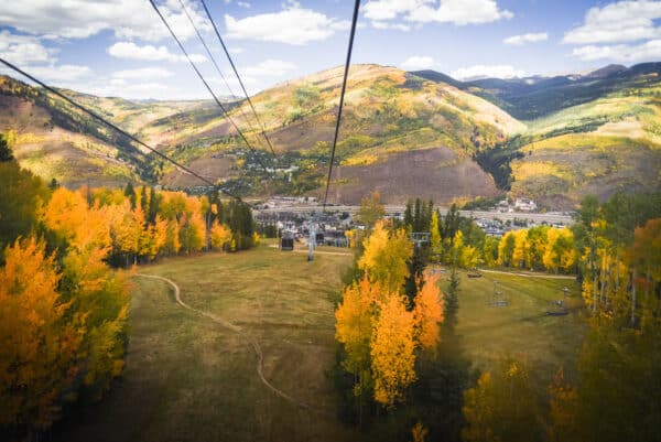
Take the trail less traveled — there are more than 100 miles of hiking trails in the Vail area! Use the trail guide to discover area trails and, whenever possible, ride a bike or take a free Town of Vail bus to the trailhead.

Dogs & Leashes

Dogs are allowed in the White River National Forest, but may not be on permitted in certain areas of Vail Resorts. Please adhere to any posted signs. We recommend that you keep your dog on a leash when you are in Vail Resort and around other forest users, other dogs, or are in bear country.

Explore Other Hikes

Everkrisp trail sign in open field with grasses

Everkrisp Trail

CLOSED through June 20 The Everkrisp Trail, opened in 2019, is a 4.1-mile mixed-use trail connecting Minturn and Eagle-Vail. The trail climbs a total of 708 feet as it ascends... (Read more)
bighorn creek trail

Bighorn Creek Trail

The first 1/2 mile of the trail climbs steeply out of the Vail Valley, then more gradually climbs up through stands of aspen and pine. The trail passes beaver ponds... (Read more)
autumn landscape with chairlift

Kinnickinnick Trail

From the top of Gondola One at Mid-Vail, towards the 10th Restaurant, there will be a a skinny path uphill to the Kinnickinnick Trailhead alongside Meadows Loop Trail. The initial... (Read more)
A silver gondola with a Vail logo on it heads up the mountain on a series of cables. Green trees and foliage blanket the terrain in the background.

Cabin Trail

Cabin Trail is a moderately steep 2 mile single track trail, which crosses a few small streams along with groves of aspen trees and an abundance of wildflowers. The trail... (Read more)
Three girls hiking on top of a mountain in the fall with yellow grass in the foreground and yellow aspens and mountains in the background.

Game Creek Trail

Game Creek Trail in Vail, Colorado, is a picturesque hiking trail that offers stunning views of the surrounding mountains and forests. The trail begins near the top of Vail Mountain... (Read more)

Ptarmigan Loop

If you’re a fan of wildflowers and stunning vistas, Ptarmigan Loop trail is a must-visit. Starting from the end of Ridge Route and the peak of the Game Creek ski... (Read more)
Family hiking through aspens

Strawberry Lane Trail

This alternative beginning of the Berry Picker Trail starts from the Vail Village Gondola One base. Ascend steeply through aspen groves, navigating small streams—some bridged, some not. Mind your step... (Read more)
North trail trailhead sign

North Trail (Trapper's Run)

CLOSED April 15 – June 20 The trail climbs gradually through pine and aspen. Along the way, there are good views of Vail Mountain. The trail ends on Davos Road.... (Read more)
Piney Lake near Vail glimmers in shadows with rugged mountains all around it. The sky is cloudy with just a hint of blue peeking out.

Upper Piney River Trail

Upper Piney Trail, located near Vail, Colorado, is a 6-mile out-and-back route that offers a moderately challenging hike with diverse scenery. Starting at Piney Lake, one of Vail’s most picturesque... (Read more)