


Shrine Ridge Trail
Distance
2.2 miles (one way)Difficulty
IntermediateCrowds
ModerateBeginning Elevation
11,000 ftEnding Elevation
11,747 ft,Elevation Gain
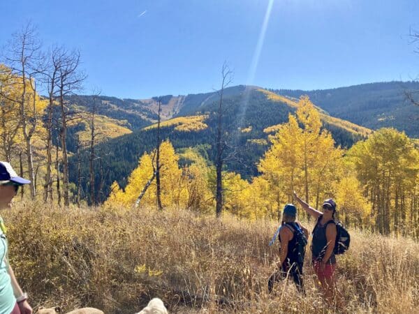
747 ft.Shrine Ridge Trail begins at the trailhead located off I-70, leading hikers through lush alpine meadows adorned with vibrant wildflowers during the spring and summer months. As you ascend, you’ll be treated to panoramic views of the surrounding peaks, including the iconic Mount of the Holy Cross. The trail is categorized as intermediate, with some steep sections, but the breathtaking vistas make it well worth the effort. Wildlife sightings are common, so keep your eyes peeled for deer, elk, and other native species. Whether you’re seeking a peaceful nature retreat or a challenging hike, Shrine Ridge Trail offers an unforgettable outdoor adventure in the heart of Colorado’s wilderness.
Care for Colorado: Leave No Trace
Exploring Vail goes hand in hand with caring for our beautiful natural environment. Here’s how you can do your part!
Stay on the Trail
No shortcuts — going off trail compromises trail construction, kills the vegetation, increases soil erosion and may result in reduced water quality.
Pack Out Trash
Stash it until you can trash it — anything you bring with you, you must pack back out. Trash can hurt wildlife and contaminate water ways.
Dog Do's and Don'ts
Do pick up the doo — pack out all dog poop. Don’t let dogs off leash to protect them from wildlife and protect wildlife from them.
Respect Wildlife
Give them space — observe wildlife from a distance and do not follow or approach them. Never feed animals as it can alter their behavior.
Plan Ahead
Take the trail less traveled — there are more than 100 miles of hiking trails in the Vail area! Use the trail guide to discover area trails and, whenever possible, ride a bike or take a free Town of Vail bus to the trailhead.
Dogs & Leashes
Dogs are allowed in the White River National Forest. Please adhere to any posted signs. We recommend that you keep your dog on a leash around other forest users, other dogs, or are in bear country.
Explore Other Hikes

Lower Piney Trail
Game Creek Trail

North Trail (Red Sandstone to Son of Middle Creek)

Upper Piney River Trail

Ptarmigan Loop
North Trail (Buffehr Creek to Red Sandstone)
Everkrisp Trail
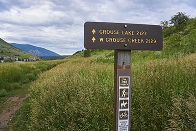
Grouse Lake Trail
